Sunday, June 30, 2019

Then and Now: Alexanders on Lexington Avenue, NYC

Alexander's on Lexington Avenue

Alexander's on Lexington Avenue, NYC, in the 1970s, randommusings.filminspector.com
Looking south from 59th Street on Lexington Avenue, NYC, in the 1970s.
People who were in Manhattan a few decades ago undoubtedly remember Alexander's Department Store. Alexander's was one of a swarm of department stores with their headquarters or major locations in Manhattan in the middle years of the 20th Century. These included names like Macy's, Gimbels, E.J. Korvette, Bloomingdale's, Ohrbach's, and Sears. Most of them are gone or currently on their deathbed (coughcoughSearscoughcough), and Alexander's fell along with several others. Seeing the above picture of Alexander's entrance brought back some memories, so I decided to do a comparison of Alexander's location on Lexington Avenue between 58th and 59th Streets from the 1970s and 2018.

Lexington Avenue looking south from 59th Street, NYC, October 2017 (Google Street View).
Alexander's was a big store, though the entrance on Lexington Avenue in Manhattan shown in the picture at the top of this page wasn't particularly impressive. It occupied the entire block between 58th and 59th Streets between Lexington and Third Avenues. Located just south of Bloomingdale's on Lexington, Alexander's always faced stiff competition. However, Bloomingdale's aimed at the high-fashion set while Alexander's was aimed more at the middle class, so there was enough business for both of them. I remember Alexander's had a lunch counter on one of the upper floors, a classic greasy spoon that looked like it came out of the 1950s (good greasy chicken). Anyway, as the recent shot above establishes, Alexander's is long gone, having closed down in 1992. While Alexander's corporation still exists as a publicly traded REIT (NYSE: ALX), but it no longer operates a department store chain. The Alexander's saga is probably most remembered these days to the involvement of Donald Trump, who held about a quarter of the company for about five years until relinquishing his interest in 1991 during his financial issues resulting from the recession of the early 1990s.

Lexington Avenue looking south from midway between 58th and 59th Street, NYC, October 2017 (Google Street View).
The Alexander's building was replaced in 2004 when 731 Lexington Avenue opened. It is one of the taller buildings in Manhattan and sometimes is called Bloomberg Tower because Bloomberg's operations are based there.

Bloomberg Tower at 731 Lexington Avenue, NYC, in October 2017 (Google Street View).
The building itself, though, is still owned by Alexander's REIT, the successor to the defunct retail chain. So, Alexander's is still there, it just doesn't operate its own store there (or anywhere) anymore. Instead, it is just the landlord, which actually is a better business to be in anyway.

The western side of Lexington Avenue looking south from 58th Street, NYC, October 2017 (Google Street View).
Also visible in the 1970s photograph was the west side of Lexington Avenue between 58th and 57th Streets. Aside from the building on the southwest corner of 58th Street, which appears to have been replaced by a glass-and-metal building of roughly the same size, all of the building (even those in the distance) appear unchanged. The background is eerily similar despite the passage of forty years or more. That's just more evidence that change in New York City occurs in swirls and eddies, and large sections of the cityscape remain unchanged for decade after decade.

I hope you enjoyed this entry in our "the more things change, the more they stay the same" series. The Alexander's story shows that even when things change on the surface in New York City, they stay the same in the background - Alexander's still owns its property on Lexington Avenue in 2019 despite the demise of its department stores. Please visit some of our other pages in this series to see how city locations have evolved over the decades.

2019

Friday, June 28, 2019

Then and Now: Jay Street at Fulton Streets, Brooklyn

Jay Street at Fulton Street, Brooklyn

Fulton Street at Jay Street in Brooklyn, NYC, randommusings.filminspector.com
Jay Street at Fulton Street, 1972.
Being a resident of Manhattan, I fondly refer to everywhere else in New York City as the "outer boroughs." One of the differences between Manhattan and the outer boroughs is that there is more change in Manhattan. That doesn't mean there is no change in the outer boroughs, it just means that change is a little more rapid on Manhattan Island. I noticed the above photo from 1972 of a typical Brooklyn street and wondered what it might look like now. So, I did this comparison of Fulton Street at Jay Street in Brooklyn from 1972 to 2017.

Fulton Street at Jay Street in Brooklyn, NYC, randommusings.filminspector.com
Jay Street at Fulton Street, September 2017 (Google Street View).
As I expected, not a lot has changed in 45 years on this particular corner of Brooklyn - and this area is not preserved as a historic district or anything like that. There is still a bus stop, the traffic pole is still there, and the buildings are unchanged. In fact, I don't think a single building in this view has changed with the possible exception of one at the extreme right. There's even an antenna at the right which appears to be the same. I mean, you could be looking at the same place at the same time - but there are 45 years in between the two photos!

Fulton Street at Jay Street in Brooklyn, NYC, randommusings.filminspector.com
Jay Street at Fulton Street, September 2017 (Google Street View).
Viewing this from a slightly different angle shows the only real change over 45 years. That is the occupants of the buildings themselves. Chock full o'Nuts is gone, though the company itself survives. Chock full o'Nuts began as nut shops in 1926 and introduced lunch counters under the Chock full o'Nuts brand name in 1932. While Chock full o'Nuts basically exited the counter business in the 1980s, it since has opened a few in the 2010s. They didn't return to this location on Fulton Street, but there are two in Brooklyn at 1611 Ave M and at 1510 Ave J.

Fulton Street at Jay Street in Brooklyn, NYC, randommusings.filminspector.com
Jay Street at Fulton Street, September 2017 (Google Street View).
Another store present in 1972 was the Thom McAn shoe store down the block. Those born after 1990 may not even realize that there ever were Thom McAn shoe stores, but they were everywhere back in the day. When you were a kid who needed shoes, your parents took you to Thom McAn. It invariably meant a long, uncomfortable wait as you sat in the uncomfortable chairs and played with the intricate little shoe measurement devices laying about on the floor with your feet. You had your choice of about three different pairs of sneakers, none of them particularly impressive but guaranteed to last the year you would wear them before your feet grew and you needed a new pair. The last Thom McAn stores closed in 1996, but the brand survives - owned by Sears. Great move there, right? The location nearby is now occupied by a Payless Shoe Store - kids still need sneakers, right? The Al Bundy shoe salesmen of the world can feel safe, their jobs are still there if they want them.

Fulton Street at Jay Street in Brooklyn, NYC, randommusings.filminspector.com
Jay Street at Fulton Street, September 2017 (Google Street View).
The John's Bargain Stores has been replaced by a hairdresser, while the Chock full o'Nuts is now a pawn shop. As the song goes, the little things of life go on, as time goes by.

I hope you enjoyed this entry in our continuing "the more things change, the more they stay the same" series. This one really surprised me due to the eerie resemblance of this section of Fulton Street to the same spot in 1972, but there's something to be said for continuity and neighborhoods continuing to meet the needs of their inhabitants. Please visit some of the other pages in this series!

2019

Wednesday, June 26, 2019

Then and Now: Stuyvesant Street, NYC

Stuyvesant Street, East Village, NYC

Stuyvesant Street from Third Avenue randommusings.filminspector.com
Stuyvesant Street at Third Avenue, NYC, in 1980.
I saw the above picture of Stuyvesant Street in the East Village from 1980 and was struck by the strange "hat" topping the white building in the center of the picture. Apparently, the photographer was, too, since he or she stopped to take the picture. So, I decided to do a comparison of Stuyvesant Street from 1980 to 2018.

Stuyvesant Street from Third Avenue randommusings.filminspector.com
Third Avenue at Stuyvesant Street in September 2017 (Google Street View).
A recent view from the same spot showed that the extension on top of the white building is gone. That is no surprise. Perhaps a little more surprising is how little the rest of the view has changed in four decades. The white building is still there, as is the two-story building to its right. The view now looks across the George Hecht Gardens, funded by a local businessman in 1999, rather than just an empty concrete square. That newish building on the left is an NYU dormitory (originally built by NYU as an apartment building, but community opposition forced its use as a dormitory instead).

Stuyvesant Street Barney Building, NYC, randommusings.filminspector.com
34 Stuyvesant Street (Google Street View).
The white building is 34 Stuyvesant Street, now home to NYU's Edgar Starr Barney Building of NYU Steinhardt, where they teach studio art (Department of Art and Art Professions). As local residents know, NYU has been steadily gobbling up properties throughout Greenwich Village and the East Village for decades. Cooper Union also owns property just to the right of the original 1980 photo. The Barney building was once the home of the Hebrew Technical Institute, founded in 1884, and was named after the principal there who served for pretty much all of its history until he passed away in 1938. In fact, in 1939, after Barney passed away, NYU acquired the building and put it through a  major remodel.

Stuyvesant Street from Third Avenue randommusings.filminspector.com
10 Stuyvesant Street (Google Street View)
The brown building to the right appears to be right next to the NYU building due to the photographer's perspective, but in fact, it is widely separated from it. It now houses a number of bistros and so forth, which does not appear to be the case in the 1980 photo (it is hard to tell, but it looks like it was a garage of some sort). Autre Kyo Ya Restaurant, described as a "fusion of Japanese and French cuisine," is in the middle of the row at 10 Stuyvesant Street. Unfortunately, it has permanently closed as of 2019, which is the typical fate for new restaurants in Manhattan. Too bad, because the Yelp reviews were pretty good.

Old houses on Stuyvesant Street, randommusings.filminspector.com
North side of Stuyvesant Street at the intersection with 9th Street. On the left is the NYU dorm on the corner, on the right is the Hamilton Fish house (Google Street View, September 2017).
In the original photo from 1980, there is a building on the left that looks like it is in poor shape. I thought it was a bombed-out building, reflecting my dim view of the East Village during the 1970s. Actually, though, the building looks worn out because it was/is just old. The row of buildings on that side of the street is one of the oldest in the city. They all date at least from the 1840s to 1850s, which is pretty old for New York City, and some from a bit earlier. The oldest building in the row is the Hamilton Fish house at 21 Stuyvesant Street which was built in 1804 by Peter Stuyvesant's great-grandson (also named Peter Stuyvesant) while Thomas Jefferson was President. Anyway, that's why that building looks so bad, because it is old, not because it was abandoned or anything like that.

Stuyvesant Street at Ninth Street, NYC, randommusings.filminspector.com
The intersection of 9th Street and Stuyvesant, with Stuyvesant on the left running due west (Google Street View).
Incidentally, Stuyvesant Street runs diagonal to the regular grid pattern of Manhattan. This is not too unusual in downtown Manhattan, where the original street directions were maintained regardless of where they led. However, Stuyvesant Street is unique because it is practically the only street in New York City that runs true east-west. The standard Manhattan grid pattern actually runs to the northeast (at a 28.9-degree offset), not true north. It is named for Petrus (better known as Peter) Stuyvesant, who was a Dutch farmer and leader of the community who owned a large farm in the area in the 1600s. So, in the above picture, where Stuyvesant Street veers off to the left and 9th Street to the right, it is actually Stuyvesant Street which points west.

Anyway, I hope you enjoyed this entry in my "the more things change, the more they stay the same" series. Oh, and I never did find out what that fancy antenna on top of the Barney Building was. Perhaps it had something to do with an industrial arts class, which was the building's purpose after its acquisition from the Hebrew Institute. Thanks for stopping by, and please visit some of the entries in this series!

2019

Tuesday, June 25, 2019

Then and Now: Broadway at West 89th Street, NYC

Broadway at 89th Street, Upper West Side, Manhattan

New Yorker Bookshop and Theater, NYC, randommusings.filminspector.com
The New Yorker Bookshop and New Yorker Theater in 1972 (Rafael Macia).
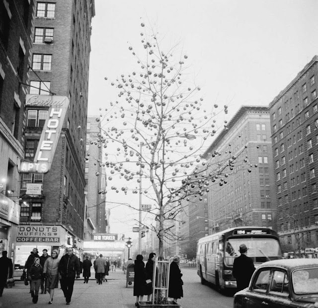
I stumbled upon the above photo from the 22 March 1971 New Yorker magazine and decided to find out what happened to this site. The photo accompanied a blurb requesting submissions from local artists (who had to live or work between West 72nd and 110th Streets between Central Park and the Hudson River) by the West 89th Street Block Association. The objective was to cover "the ugly north wall of the New Yorker Theater" with a mural, to be painted by a professional mural-painting company. So, with a few extraneous stops along the way, here is a comparison of West 89th Street at Broadway on the Upper West Side from 1971 to 2018.

New Yorker Bookshop and Theater, NYC, randommusings.filminspector.com
Southwest corner of 89th Street at Broadway ca. 1914 (Museum of the City of New York).
First, stepping a bit further back in time, this was the southwest corner of West 89th Street at Broadway around 1914. It appears that "ugly north walls" was a longstanding tradition on the block.

New Yorker Bookshop and Theater, NYC, randommusings.filminspector.com
Broadway looking north from West 88th Street, showing the Broadway entrance for the New Yorker Theater in the distance, 1964.
Taking a slightly different perspective on the area, above is a view north from West 88th Street in 1964. The marquee of the New Yorker Theater is visible.

New Yorker Bookshop and Theater, NYC, randommusings.filminspector.com
West 89th Street at Broadway in 1973.
Skipping back to the future, we can see the results of the mural competition in the above photo of West 89th Street from 1973. Isn't it nice to be able to do that? I'm no art critic, but my review of the completed mural is that ... it could have been a little more adventurous. I mean, I'm not the most daring fellow in the world, but even I sometimes put some pepper sauce on my chile. However, that whole "counterculture" thing was going on at the time and the leaders of the West 89th Street Block Association probably weren't the most radical people in the area. Anyway, it certainly makes a wall... a little less ugly. Also visible at the extreme right is 270 West 89th Street, the B'nai Jeshurun Community Center. That building dates from 1928. Just beyond (on this side of the New Yorker Theater) is one of those quintessentially New York brownstones that is impossibly thin but somehow always seem to survive wars, famine, and pestilence. There's a reason there are so many such "tiny" homes in Manhattan: the property tax laws back in the day were calculated by street frontage. Thus, the incentive was the build high and deep, but not wide. That building dates from 1899 and is a multi-family home.

New Yorker Bookshop and Theater, NYC, randommusings.filminspector.com
The old New Yorker Theater. West side of Broadway 88th to 89th Streets, c.1977. Photo by Nicholas West.
Above is yet another perspective on the southwest corner of West 88th Street at Broadway. Note the large marquee for the New Yorker Theater. The theater had its public entrance on Broadway but its backstage area mostly located on West 89th Street.

New Yorker Bookshop and Theater, NYC, randommusings.filminspector.com
West 89th Street and Broadway, 1970s.
Not visible in the above photos is the New Yorker Bookshop, which likely is the one thing many local residents will remember from the period. The New Yorker Bookshop was located just east of the New Yorker Theater on 89th Street, in the "L" formed by the theater. Now, which business was named "New Yorker" first, the theater or the bookstore, is a very good question, but I'm betting it was the theater. In any event, the New Yorker Bookshop was a community treasure. In the 1960s and 1970s, bookstores were often community centers where older folks could read up on Marx and the younger set could get the latest from Saul Alinsky. Incidentally, if you wanted to enter that mural competition mentioned above, you had to go to the New Yorker Bookshop for entry requirements and to make your submissions.

New Yorker Bookshop and Theater, NYC, randommusings.filminspector.com
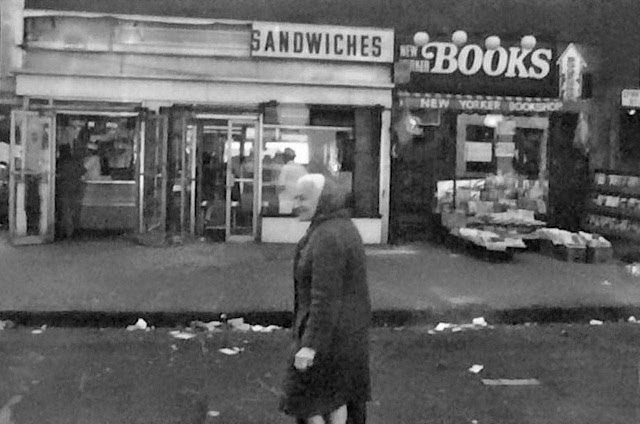
New Yorker Bookshop on the day that it closed, 19 May 1982.
The New Yorker Bookshop, described in a New York Times article of 20 May 1982 as "something of an Upper West Side institution," closed up on 19 May 1982. Clearly, the closing was considered a major event if the Times wrote an article about it. The closing of the New Yorker Bookshop, at least in retrospect, was the beginning of major changes for the block.

New Yorker Bookshop and Theater, NYC, randommusings.filminspector.com
The current building on the southwest corner of 89th Street at Broadway (Google Street View, October 2017).
Due to certain New York City tax incentives, a wild building spree took place in Manhattan in the mid-1980s. The law said something along the lines of, "you'll get a huge tax abatement if you complete your building by 1986." This led to construction up and down Manhattan Island. Among those new buildings was the completion of the Savannah apartment building on the corner of West 89th Street at Broadway in 1986. It is a handsome building even though IMHO its modern style doesn't really fit in with the more venerable buildings all around it. The Savannah took over the entirety of the New Yorker Theater and New Yorker Bookshop locations. The Savannah is 250 West 89th Street, the old street number of the New Yorker Bookshop.

New Yorker Bookshop and Theater, NYC, randommusings.filminspector.com
262 and 270 West 89th Street (Google Street View, October 2017).
As for 262 and 270 West 89th Street, they're both still there. The brownstone at 262 last sold in 1976 for $110,000 and currently is valued at more than $5 million. The B'nai Jeshurun Community Center was renovated by preservation architect Giorgio Cavaglieri around 1999 to return it to its original 1928 appearance. Those old buildings need a lot of maintenance, and it looks like that was the case when the Google Street View van passed by in October 2017. Oh, and you may notice something else - the presence of trees again, just like in the 1914 photo. They make a big difference in softening a city landscape.

Anyway, getting into the minutiae of changes on one block in a big city may not seem that important. However, these changes really matter to the people who live there. Thanks for visiting this installment of our "the more things change, the more they stay the same" series. Please visit some of the other entries in the series!

2019

Then and Now: Nedick's in Times Square

Nedick's at the Corner of 7th Avenue and 42nd Street

Nedick's location in Times Square, NYC, randommusings.filminspector.com
Nedick's at the corner of 7th Avenue and 42nd Street in 1971.
Nedick's was an early fast-food chain. Begun just before World War I, it predated its more famous successors such as McDonald's and Burger King by decades. The first Nedick's was at 23rd and Broadway, but the Nedick's formula caught on and its most famous stand was at the northwest corner of 7th Avenue and 42nd Street. Its name came from combining the last names of its two founders Robert T. Neely and Orville A. Dickinson. They didn't have the fast-food formula down pat in the early 20th Century, and instead of selling the later standard offerings of burgers and fries, Nedick's relied more on hot dogs and its distinctive orange drink which was sort of a combination of orangeade and orange juice. It had pulp, but also a lot of sugar, so it wasn't some kind of health tonic. Just to show how different the times were, the orange Nedick's drink wasn't even carbonated. As tastes changed over the decades, soda took over and Nedick's orange drink increasingly seemed archaic if not downright toxic (if you have fond memories of it, don't get upset, non-carbonated drinks just fell out of fashion, I'm sure it had a lovely flavor). Anyway, this is a comparison of the old Nedick's location at 7th Avenue and 42nd Street from the 1940s to 2018.

Nedick's location in Times Square, NYC, randommusings.filminspector.com
Nedick's in Times Square in 1946. Note the dentist's office on the second floor. (IMAGE: ANDREAS FEININGER/ TIME LIFE/GETTY IMAGES via Mashable).
Nedick's in Times Square was next to the White Rose Bar & Grill. While it's nice to imagine that "back in the day" all of the places were quaint and unique, in fact, the White Rose Bar was just part of another chain with several locations in the city.

Nedick's location in Times Square, NYC, randommusings.filminspector.com
Nedick's in Times Square in 1947 (photo by future filmmaker Stanley Kubrick).
Nedick's was on just another street corner. Anyone familiar with Manhattan knows that the majority of it (except for some of the older areas) is based on a strict grid pattern. While the corner of 7th and 42nd Street undeniably was a top location at the "crossroads of the world," it was just like every other rectangular street corner in the city. This meant the ubiquitous newspaper stand nearby where you could get the latest New York Times or the latest copy of Life magazine. The newsstands did big business on Sundays when people bought the Times for the real estate listings and expanded sports section.

Nedick's location in Times Square, NYC, randommusings.filminspector.com
Nedick's in the background of a scene in "Taxi Driver" (1975). This was when Times Square had reached its heights of seediness, which fit the theme of the film.
Nedick's reached its peak in the 1950s. That was when hot dog stands reigned supreme. However, burger joints already were starting to pop up, and the rise of McDonald's in the 1960s and 1970s made hot dog places like Nedick's virtually obsolete. The chain ceased operations during the 1980s. A brief revival around 2003 was unsuccessful. However, the name "Nedick's" remains a valuable property, and future comebacks in some format are not inconceivable.

Nedick's location in Times Square, NYC, randommusings.filminspector.com
The old Nedick's location no longer features a standard rectangular streetcorner. Instead, it has a curved corner which facilitates the incorporation of 42nd Street between 7th and 8th Avenues into the Times Square milieu (Google Street View October 2018).
The Times Square Nedick's was in a storefront of 3 Times Square. This was the Hermitage Hotel, which became the National Hotel at some point. The building was demolished in the 1990s as the city made a major push to revitalize the Times Square area and turn it into a family-friendly tourist destination again. As part of this, 3 Times Square was demolished beginning in 1998 and replaced by a generic office building known as the Thomson Reuters Building.

Nedick's location in Times Square, NYC, randommusings.filminspector.com
Looking north along 7th Avenue from 42nd Street (Google Street View October 2018).
Thus, all traces of the old Nedick's location have been obliterated aside from the surrounding streets. It is easy to get misty-eyed and sentimental about the end of one era and the beginning of another, but the Nedick's in Times Square had become more of a relic than a profitable business. The new 3 Times Square is energy efficient and sports the modern video screens on the exterior that are de rigueur in Times Square these days. The Nedick's spot is still a heavily trafficked location, only now people are not stopping for dogs and a drink but instead are heading over to Disney and Madame Tussaud's around the corner.

I hope you enjoyed this entry in our "the more things change, the more they stay the same" series. Please visit some of our other pages to join our journey into how city locations gradually evolve to meet the needs of successive generations.

2019

Monday, June 24, 2019

Then and Now: Howard Johnson's in Times Square

Howard Johnson's at Broadway and 46th in Times Square, Manhattan

Howard Johnson's in Times Square, NYC, randommusings.filminspector.com
Howard Johnson's at Broadway and 46th Street in Times Square ca. 1970.
One of the continuing themes of this blog is the importance of neighborhood "joints." By that, I mean a local establishment that has no real status outside of its own neighborhood but still is iconic to those who live nearby. Such a joint was the Howard Johnson's in Times Square. After stumbling across the above picture, I decided to do a comparison of the Howard Johnson's location in Times Square from the 1960s to 2018.

Howard Johnson's in Times Square, NYC, randommusings.filminspector.com
Photo of Howard Johnson's in Times Square by Bob Gruen, 1972.
A little research revealed that Howard Johnson's opened its Times Square location in 1955. It was not a particularly auspicious moment to open a family restaurant in Times Square. The area was right on the verge of descending from "crossroads of the world" to outright seediness. Times Square was always a free-wheeling place, but things changed dramatically in the 1960s. Not that there's anything particularly wrong about seediness if that is your thing, but Howard Johnson's and seediness went together about as well as a fish and a bicycle. And, Howard Johnson's knew something about fish, I really enjoyed the fried clams at the one near me. However, knowing about the other stuff - not so much. While I could go into a long dissertation about why Times Square changed from the 1950s to the 1960s and then back again in the late 1990s, that is a very tricky subject with a variety of nuanced reasons. Fortunately, in this blog, we are more concerned with what happened, not why it happened.

Broadway and 46th Street in Times Square, NYC, randommusings.filminspector.com
The northeast of 46th Street and Broadway in Times Square in August 2014 (Google Street View).
The Howard Johnson's on Times Square was favored by photographers because of the contrasts it posed with its neighbors. Well, let's cut to the chase. The Howard Johnson's in Times Square was sold for over $100 million by longtime owner Kenneth Rubinstein to Jeff Sutton's Wharton Acquisitions in 2005. At that time, Howard Johnson's in Times Square was the oldest, continually operated business facing directly on Times Square. There actually had been three Howard Johnson's in the Times Square area right after World War II, that's how popular the chain was at that time. The one at 46th Street and Broadway survived on the tourist trade, as its homey atmosphere contrasted sharply with the increasingly decadent area surrounding it and seemed like a safe place to satisfy hunger pains. The downfall for this last Howard Johnson's was the dramatic rise in real estate prices as the seedy local enterprises were replaced by Madame Tussaud's, Disney, and other international brands. These places diverted tourist crowds to their own locales and patronage of the older places died away. The theater people who also could sustain an eatery on Times Square were never Howard Johnson's fans (aside from a few old-timers like Gene Hackman and Lily Tomlin who actually worked there at one time or another) due to its somewhat "square" image.

Broadway and 46th Street in Times Square, NYC, randommusings.filminspector.com
The northeast corner of 46th Street at Broadway in October 2018 (Google Street View).
The business above the Howard Johnson's was the “Follies Burlesk,” a campy review which had taken over the circa-1917 Orpheum Dance Palace during the 1960s. It closed in 1976 and was replaced that year by the "Gaiety Male Burlesk," advertising “six boys five times a day.” The Burlesk closed in 2005 after thirty years in business shortly before the Howard Johnson's. One can point to the building's sale as the culminating reason why the businesses there closed, but the neighborhood was changing and leaving them behind anyway. So, their demise was only a matter of time that just happened to take place in 2005. It is perhaps unnecessary to point out that there are no longer any "Burlesks" in Times Square, as the entire area has become more family-friendly. In fact, even such places over on Eighth Avenue are gone or at least completely repurposed in a very family-friendly way. The times have changed, and Times Square has changed with them.

Broadway and 46th Street in Times Square, NYC, randommusings.filminspector.com
The northeast corner of 46th Street at Broadway in October 2018 (Google Street View).
Now, the street-level space at the northeast corner of Broadway and 46th Street is occupied by a clothing store. Above it can be seen formless modern advertising signs composed of the sorts of flashing images that now define Times Square. The area in front of the location has become a pedestrian mall. It is all very bland and tourist-friendly, inoffensive and innocuous. While the seedy businesses thrived in a turbulent era, now overwhelming commercialism has taken over. In a sense, Times Square has returned to its roots as a crossroads of the world, when the world is defined as selling people products made by global brands.

I hope you enjoyed this entry in my "the more things change, the more they stay the same" series. Please visit some of the other pages in the series to see how neighborhoods have been transformed in large ways and small over the decades.

2019

Sunday, June 23, 2019

Then and Now: Empire Diner, NYC

Empire Diner at 10th Avenue and 22nd Street, Manhattan

Empire Diner randommusings.filminspector.com
Empire Diner at 22nd Street and 10th Avenue in the 1970s, as it appeared in Woody Allen's classic film "Manhattan" (1979) (Prod DB © United Artists).
I have mentioned the Empire Diner once or twice already in this series of articles, but when I saw the above picture, I decided to do a more formal write-up on it. The Empire Diner was built by the Fodero Dining Car Company in 1946 with an Art Deco style typical for the era (there were similar diners throughout upstate New York and elsewhere, the Empire Diner was hardly unique except for its location). It eventually went bankrupt. Unlike some other such New York City diners which were towed off to other cities, the Empire Finer was refurbished to its current splendor.

Empire Diner randommusings.filminspector.com
Empire Diner in the early 1980’s  (Larry Cultrera).
The original owners kept the Empire Diner until 1976 when it was remodeled (this turns out to be a theme with the diner, new owners remodeling it). It since has closed again (in 2010), reopened as the Highliner, closed again (in 2012), and reopened again (in January 2014) again under its original name and then apparently closed again in 2015 before reopening in November 2016. It's hard keeping up with all the openings and closings, to be honest, but it apparently is open as of this writing. I thought I could identify the exact date of the photo at the top from the "Walk/Don't Walk" sign on the street corner, but my research showed that they first appeared in February 1952 and were replaced from 2000-2004. Anyway, this is a comparison of the Empire Diner at 210 Tenth Avenue from the late 1970s to late 2017.

Empire Diner randommusings.filminspector.com
The Empire Diner in September 2017 (Google Street View).
As can be seen from the above photo from 2017, the basic layout of the Empire Diner hasn't changed that much. The building beyond still has the big "EAT" sign (though a little less prominent) and the shiny exterior has not been changed much. Personally, I preferred the old "EAT" style, but I'm not the one paying for it, so it's nice that there is still one there at all. There has been the addition of an outdoor seating area, giving the space a much more welcoming atmosphere. The traffic light pole remains, though the "Don't Walk" (or "Dont Walk" as they actually appeared) sign has been replaced with the more generic picture-symbol signs (tourists apparently didn't understand the old signs and kept getting run over). There also is the notable addition of greenery, something that pops up in almost all of these comparisons. A few trees and vines and so forth go a great way toward softening the angular harshness evident in old New York City photos such as the one at the top of this article.

Empire Diner randommusings.filminspector.com
The Empire Diner in September 2017 (Google Street View).
A slightly different angle shows the addition of a large mural at some point in the intervening years. This is entirely fitting given the Empire Diner's neighborhood status as an artist hangout (the area has become favored by artists in recent years). I remember stopping by the Empire Diner in the early 1990s when a friend worked there. It looked exactly as you would expect, the long counter with stools and a cooking area directly behind. There was a neighborhood effort to get both the exterior and interior Landmark status which fizzled. The interior since has been completely reworked by Nemaworkshop’s Anurag Nema with very, you know, tasteful tables and chairs. I mean, I liked the old vinyl and other mid-century touches, but times change and it's a wonder the Empire Diner has survived in any incarnation, much less one that retains at least the classic exterior.

Empire Diner randommusings.filminspector.com
The Empire Diner in 2009, showing the statue of the Empire State Building shortly before it was removed. The diner had fallen into decrepitude by this time.
A kitschy stylized statue of the Empire State Building on the diner's corner added to its historic feel (those sorts of statues were very common tourist souvenirs once upon a time). The statue was removed in 2010 when ownership changed (leading to wild rumors that the entire site was about to be demolished) and has not been replaced. Current ownership apparently is going for a more modern chic look. Attempts to capitalize on the conversion of the High Line railway line, which is only a couple of blocks away into a tourist attraction haven't been too successful, though the few tourists that do wander over may be the only reason the Empire Diner still exists at all. I am familiar with the area and the problem isn't the diner or the design or anything like that, it simply is that there isn't a lot of foot traffic on that part of 10th Avenue. All of the tourist spots are blocks away. As they say in real estate, the only three things that matter are location, location, and location. On the flip side, if that area of Chelsea were more popular, it probably would have been completely gentrified over the years, property values would have gone through the roof, and the Empire Diner would be long gone. So, there is good and bad in everything.

Empire Diner randommusings.filminspector.com
The Empire Diner has appeared in several films throughout the years. This is its appearance in "Home Alone 2" (1992) (TWENTIETH CENTURY FOX).
Anyway, there obviously is a lot of affection throughout the community for the Empire Diner. It has had its ups and downs over the years, but it is still there, and that ain't beanbag. Hopefully, you enjoyed this entry in our "the more things change, the more they stay the same" series. I hope you have a chance to visit some of the other pages in this series in which we look at iconic and not-so-iconic spots in the city and see how they have changed over the years.

2019

Saturday, June 22, 2019

Then and Now: Front Street at Brooklyn Bridge, NYC

Front Street at the Brooklyn Bridge, Brooklyn

Front Street at Brooklyn Bridge, NYC, randommusings.filminspector.com
Front Street at the Brooklyn Bridge, 1977.
It's no secret that iconic structures like the Brooklyn Bridge haven't changed in the lifetime of anyone currently living. They likely won't change during anyone's current lifetime, either. So, choosing some old photo of the Brooklyn Bridge and comparing it to a current view really doesn't prove anything. However... the things around these iconic structures can and do change... sometimes. And then again, sometimes they don't. So, I saw the above photo from 1977 and wondered what the current state of that evocative and picturesque scene was today, over four decades later. Did the photographer capture a fleeting moment in time, the light of a firefly before it winked out in the night? Or, did he or she just choose an interesting spot and take a quick snap that could be duplicated today? And, if the latter, is there anything else about the scene that has changed? So, I decided to do a comparison of Front Street at the Brooklyn Bridge from 1977 to 2018.

Front Street at Brooklyn Bridge, NYC, randommusings.filminspector.com
Front Street at the Brooklyn Bridge, August 2018 (Google Street View).
Well, I hunted down the location. The building turned out to be No. 1 Front Street. This is in the DUMBO (short for Down Under the Manhattan Bridge Overpass) neighborhood. The location actually isn't under the Manhattan Bridge Overpass, but whatever, it's a New York thing.

Front Street at Brooklyn Bridge, NYC, randommusings.filminspector.com
No. 1 Front Street at the Brooklyn Bridge, August 2018 (Google Street View).
The current occupant of No. 1 Front Street is a pizza joint, Grimaldi's Pizza. Brooklyn is famous for its pizza. I'm told (I'm no expert) that the secret to a truly great pizza is a hot (very hot) coal-fired oven. Grimaldi's boasts of using such ovens. A little research on Grimaldi's web page establishes that they opened "the original, historic Grimaldi's location" in 1990. So, it's historic, though dating later than the original photo from 1977, above.

Front Street at Brooklyn Bridge, NYC, randommusings.filminspector.com
No. 1 Front Street at the Brooklyn Bridge, August 2018 (Google Street View).
Anyway, this isn't an ad for Grimaldi's, which I've never had the honor of ordering from but which I'm sure is a top pizza joint (much better than the dozens of Famous Ray's joints that dot Manhattan, at least). There are a couple of other little things I want to point out that reflect upon the passage of time. First, it appears that the street lights haven't changed (or at least the basic style hasn't changed). This may seem like a picayune detail, and perhaps it is. However, the street lamps can tell you a lot. For instance, in gentrified neighborhoods, they've begun placing fancy hooked lamposts that apparently are designed to resemble old gas lamps. In any event, the gentrified ones have that "genteel olde world" feel to them, as opposed to the genuinely older "highway or parking lot" feel. As the photo shows, the new lights haven't appeared yet in this section of DUMBO. That tells me straight off that the neighborhood may have improved over time, but it still has a ways to go to become truly (to use a 1980s term) Yuppiefied.

Front Street at Brooklyn Bridge, NYC, randommusings.filminspector.com
View of No. 1 Front Street at the Brooklyn Bridge, August 2018 (Google Street View). Pulling back a bit creates a completely different feeling.
Now, focusing on something of a little greater international import than the street lamps on Front Street, something else has changed. I probably don't have to point it out, but may as well. While not visible in the original photo from 1977 due to the photographer's angle of shooting, if he/she had glanced slightly to his left, he/she would have had an awesome view of the World Trade Center. Well, the same would be the case in 2018. However, it is a different World Trade Center. Now, who could have predicted that in 1977? I am going to make an absolutely aesthetic judgment here and say that I believe the new World Trade Center view is more beautiful than the old World Trade Center view. Of course, and this again goes without saying but I'll say it anyway, we all wish the old view were still with us.

I hope you enjoyed this entry in our "the more things change, the more they stay the same" series. Please visit some of the other pages in the series if you are interested in how a city changes over time in a (usually) evolutionary way.

2019

Friday, June 21, 2019

Then and Now: Columbus Circle, NYC

Columbus Circle, NY

Columbus Circle then and now randommusings.filminspector.com
Columbus Circle, NYC, in the 1970s. I think this gritty, dirty photo is an absolutely perfect way to sum up the state of Columbus Circle in the 1970s. The whole area had become an eyesore.
If you are driving to New York City from anywhere else, you will regular road signs giving you the distance to the city. So, you'll be 200 miles away, then 175, and so forth. Those distances are measured not from the outskirts of New York City, but from one specific location: Columbus Circle. Literally the heart of New York City (at least according to the federal government, Google uses City Hall), Columbus Circle also for a long time was extremely neglected. It had a huge, drab convention center behind it, the monument to Columbus, and a lot of cars whizzing by going somewhere else. Seeing the above photo from the 1970s of Columbus Circle looking toward the East gave me the idea of seeing how it looks now. So, this is a comparison of Columbus Circle from the 1970s to 2018.

Columbus Circle then and now randommusings.filminspector.com
Columbus Circle in November 2017 (Google Street View).
Columbus Circle has retained its essential elements such as the monument, but otherwise is a drastically different place than it was in the 1970s. The circle was renovated in the 1990s and then between 2003 and 2005 to separate the monument from traffic with a much larger traffic island and an array of fountains. The new park has won awards and has made Columbus Circle a destination rather than something to just drive around, as can be seen in the 1970s photo above.

Columbus Circle then and now randommusings.filminspector.com
Columbus Circle in 1921 (Library of Congress).
The area to the west of Columbus Circle has seen huge changes over the years, too. In the early 20th Century, all that was there was the monument, and traffic just drove right by it. At a time with less traffic and more foot traffic, this worked fine. There was a massive - for the time - building near the monument which helped to create a defined space for the monument and corraled the traffic flow into an actual circle.

Columbus Circle then and now randommusings.filminspector.com
Columbus Circle ca. 1990. The New York Coliseum is in the center of the photo. This clearly shows how traffic simply drove by the Christopher Columbus monument and how difficult it was to even get to it.
Unfortunately, in the 1950s they tore down the area behind Columbus Circle and erected the New York Coliseum, a convention center. While a perfectly functional building (they held the annual Boat Show there), the Coliseum provided an unimpressive backdrop to the area. It also blocked access from the west, an odd choice to make, and made the area into a dead zone when there wasn't anything going on in the Coliseum (which was the vast majority of the time). The area looked almost abandoned during the day and the area in front of the Coliseum like an abandoned car lot. There literally was nothing to do there during the day - no shopping, no eateries, nowhere to sit. Well, nothing to do unless you were homeless, that is, as a lot of them camped out there. It was a strange way to treat the heart of your city. The opening of the Jacob Javits Center on the West Side in 1986 removed that last shred of usefulness for the Coliseum, The Coliseum's owner, the Metropolitan Transportation Authority (MTA), knew the Coliseum was becoming a problem and put the Coliseum on the market in 1984. It took well over a decade to sell due to issues in the New York City real estate market (such as the usual community opposition to various plans which reduced the site's value to some developers). Some bidders dropped out because the city seemed half-hearted about actually doing something about the site.

Columbus Circle then and now randommusings.filminspector.com
Columbus Circle in 2018, looking west.
Finally, in 1998, the MTA sold the Coliseum to a joint venture of Time Warner and The Related Companies for $345 million. The Coliseum was demolished in 2000 and the Time Warner Center went up in its place. This undeniably was a huge improvement from an aesthetic point of view. Now, Columbus Circle is a destination again where people live and work and you can shop and eat and relax. Development nearby on Central Park South also has been energized. While the basic layout of the monument, the nearby entrance to Central Park, and nearby buildings remains intact, the meaning and usefulness of the area have been transformed. It was sort of addition by subtraction, and then some addition by addition by the replacement of a crumbling eyesore with buildings that enhanced the location rather than detracted from it.

Columbus Circle then and now randommusings.filminspector.com
The Christopher Columbus monument once again seems to fit it into surroundings (Google Street View).
I hope you enjoyed this entry in my "the more things change, the more they stay the same." Please visit some of my other entries in this series, where we explore the gradual evolution of a city from small decisions made over time.

2019