Beautiful Suburban Burbank

While some things change from year to year, others seem more permanent and rooted in permanency. We're taking a look here at a neighborhood that illustrates that perfectly.
One of late-night entertainer Johnny Carson's catchphrases was "somewhere in beautiful downtown Burbank," said in gest to convey the humble location of the studio where he filmed "The Tonight Show." Well, Johnny said that a lot closer in time to the late-1940s film that is the subject of our quick trip back in time than he was to us.
The past always seems a bit odd because it isn't familiar. But it was very familiar to the people seen in this brief drive through 1940s suburbia. Time marches on, Tempus fugit, and I am quite sure that our current gas-burners and McMansions will seem equally quaint to viewers in the year 2100. Here we take some scenes from Burbank ca. 1949 and compare them to the same locations recently.
 |
| A P-38 Lightning fighter left over from World War II takes off in the distance from the Hollywood Burbank Airport aka Bob Hope Airport (then Lockheed Air Terminal) as we drive down Maple Street. The P-38 fighter was retired from the US Air Force right around the time this film was made, in 1949. |
Below is a beautifully restored version of some old footage that most likely was captured for background shots in motion pictures of the day.
Just for comparison, here is the original footage.
Original footage courtesy of Internet Archive.
The location of our drive is "the Valley" in Los Angeles.
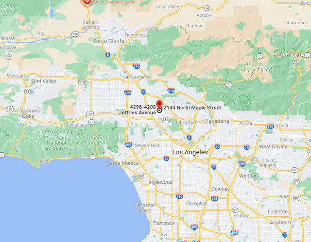 |
| The location of today's drive (Google Maps). |
Today's drive is done once and then repeated. The drive is split up into two parts, and then these two parts are repeated. That may sound confusing, but it's really not when watching the film. We are doing the same drive, which is interrupted once, over again starting about halfway through the film.
We cover mostly the same ground in each section of the drive, though the beginning and endpoints are slightly different.
The first part of our drive is from Pepper Street down Victory Street and thence to Maple Street. It isn't a very long journey, only about half a mile according to Google Maps.
The second part of the trip begins at our original endpoint at Maple and Pacific. We go down Maple down to Jeffries and stop between Ross and Valley Streets. This portion of the trip is only a bit longer than the first part. All told, in both parts of the drive, we cover barely over a mile. However, we get to see a nice slice of mid-century Americana along the way.
In a roundabout way, we are going from Pepper Street to Jeffries, with a detour up to West Pacific.
The second half of the film is the same trip again. It's not a very exciting film! But it is very interesting if you like seeing the past up close and personal.
Okay, let's compare some scenes.
 |
| Our starting point at Victory Boulevard and Pepper Street in the late 1940s. |
The area was still being built up in the 1940s, but you'll really have to hunt down empty lots now.
 |
| Victory Boulevard and Pepper Street in February 2021 (Google Street View). |
While, obviously, the scene is different in 2021, I look for similarities. It isn't difficult to see some. For instance, the street corner is still rounded. You can see the mountains in the background in the most recent photo if you look closely enough. It's the same intersection, just in different worlds. However, we can add a little bit here to prove it a little better.
I'm going to show that house in the 1940s and you'll see how stepping back a bit gives an even better resemblance.
 |
| Our starting point at Victory Boulevard and Pepper Street, late 1940s. |
Once we see the house, it all comes together. That chimney hasn't changed anything except its exterior coating. The house may have had some work done on it, but it certainly looks like the same structure. Yup, it's the same corner all right.
Let's move on to another comparison.
 |
| Victory Boulevard and Screenland Street, late 1940s. |
Okay, here we have a nice house at Victory and Screenland. Notice how the garage is off on the side street, allowing a nice presentable front appearance which was considered very important back in the day. No sidewalk in the 1940s, but you know that's going to change.
 |
| Victory Boulevard and Screenland Street, February 2018 (Google Street View). |
Checking in recently, we see that the scene hasn't changed much. Same house, same driveway off on the side street (though it appears to have been expanded)... you think they ever painted that house anything other than white? I highly doubt it. I liked the original darker roof though, tbh, made a starker contrast.
We turn right from Maple at Jeffries Street. In the late 1940s, that was a pretty desolate area, awaiting some houses and love. I bet it doesn't look like that now!
Driving south on Maple, we have just crossed Victory Boulevard and notice that large church on the left. That entrance to the cemetery sure looms in the distance, doesn't it? Let's see if the church is still there.
2021
On to another view.
 |
| Maple Street at Pacific Avenue, late 1940s. |
At the beginning of the second part of our journey, we notice a very distinctive structure on the left in the distance. It certainly dominates the landscape in that 1940s film. Hmmm, I wonder if that survived?
 |
| Maple Street at Pacific Avenue, April 2019 (Google Street View). |
You betcha! Now that there are so many trees and everything has been landscaped it no longer dominates the landscape quite as much, but that's just context. There it is in the distance at the left-center. In the 1940s, it was simply the entrance to Pierce Brothers Valhalla Memorial Park Cemetery. However, in 1953, only a few years after the film was shot, it was rededicated as The Portal of the Folded Wings Shrine to Aviation. And that is how it is known now and you can visit it if you like.
 |
| Maple Street at Jeffries, late 1940s. |
We turn right from Maple at Jeffries Street. In the late 1940s, that was a pretty desolate area, awaiting some houses and love. I bet it doesn't look like that now!
 |
| Maple Street at Jeffries, April 2019. |
That corner actually doesn't look all that different now. That empty area on the far corner has become the Maple Street Playground, and beyond it is the Luther Burbank Middle School. It was nice to have all that open land to build the school on!
 |
| Maple Street at Victory Boulevard, late 1940s. |
Driving south on Maple, we have just crossed Victory Boulevard and notice that large church on the left. That entrance to the cemetery sure looms in the distance, doesn't it? Let's see if the church is still there.
 |
| Maple Street at Victory Boulevard, April 2014 (Google Street View). |
Well, the church is still there, over there on the far left corner. It is the Victory Celebration Center (they were celebrating a big victory in the 1940s, too). However, at some point, it looks like they downsized from that big white barn-like building to something more tasteful. They certainly widened the boulevard, too. Can't really see the Shrine to Aviation in the distance anymore, too many trees - but it's definitely still there, as we have seen. Just a different look for a different time.
I hope you enjoyed this short drive into the past. As I always say, the more things change, the more they stay the same. Check out some of our other glimpses into the then and now! Thanks for visiting.
No comments:
Post a Comment
Note: Only a member of this blog may post a comment.