Friday, November 23, 2018

Then and Now: Second Avenue and 51st Street, Manhattan

Then and Now: Second Avenue and 51st Street, Manhattan

Second Avenue at 51st Street, Manhattan randommusings.filminspector.com
Second Avenue at 51st Street circa 1980.

The above ordinary street scene from the Turtle Bay area of Manhattan piqued my interest regarding that particular street corner looks like now, in the 2010s. I tracked down the location as the southwest corner of Second Avenue at 51st Street. So, I decided to do a comparison of Second Avenue at 51st Street from around 1980 to the 2010s.

Second Avenue at 51st Street, Manhattan randommusings.filminspector.com
Second Avenue at 51st Street in the 2010s (Google Street View).

The first thing that I noticed is that the A&P on the northwest corner is gone. The Great Atlantic & Pacific Tea Company already was in trouble in 1980, and it began a wave of store closings in 1981. The company stumbled on for another few decades, with moments where it seemed to be regaining strength. However, the 2009 recession hit A&P hard - why is unclear, since supermarkets should be relatively recession-proof, but the company was highly leveraged after various acquisitions - and it filed for bankruptcy in 2010. This seemed to save the chain, but then it filed for bankruptcy again in 2015 and closed all of its remaining stores by the end of that year. Considering that the location is closed in the more recent photo, this A&P may have lasted until the end of 2015. The new tenant is a CVS, which reflects an influx of pharmacies into old retail spaces. Prescriptions are a durable and growing business. People aren't cooking at home as much as they used to, either, so the switch is a sign of the times.

The buildings on the southwest corner and running down the block appear to be the same. However, they have had a lot of work done to them. The building on the corner has had windows added on the 51st Street side. The fire escape also is gone. The other buildings along the block nearest that corner also have removed their fire escape, and only a couple of those buildings down by 50th Street retain them. Personally, I like fire escapes, because they give a building character. However, I can certainly understand why you would remove them because they must be maintained and can provide entry for prowlers. The low buildings almost certainly still survive as they are by selling their lucrative air rights to those new skyscrapers behind them.

When I first glanced at the most recent picture, I thought that the tall apartment building down Second Avenue was the same. However, a closer look showed that it was not the same building at all. Whatever building was there in 1980 was replaced in 1985 by Sterling Plaza, located at 255 East 49th Street by developers Fred Wilpon and Saul B. Katz. Why they felt the need to replace the building that was there in the oldest photo is unclear, but the 1980s were a period when tax incentives spurred a lot of building in Manhattan. This surge in construction peaked in the 1985-1986 period. The absence of Sterling Plaza dates the top photo to before 1985 for certain, and probably before 1984 or even 1983 considering the typical length of time of demolition and construction. Sterling Plaza, incidentally, now is one of the top areas to live in the area.

Overall, this particular block hasn't changed much at all. You still have the low-profile line of buildings and a sea of taller ones around them. Zoning laws have made this block a sea of stability, the eye of the hurricane of new construction all around it.

Thank you for visiting this entry in my "the more things change the more they stay the same" series. I enjoy putting these together because I'm as curious how these areas change as you are!

Second Avenue at 51st Street, Manhattan randommusings.filminspector.com
Second Avenue at 51st Street in the 2010s.
2018

Thursday, November 22, 2018

Then and Now: Spring and Mulberry Streets, Manhattan

Then and Now: Corner of Spring and Mulberry Streets, Manhattan

Spring Street at Mulberry Street randommusings.filminspector.com
Southeast corner of Spring and Mulberry Streets, Manhattan, in 1976.

One of my continuing themes in this series is how little New York changes from decade to decade despite the stereotype that it is constantly changing. I found the above picture of Mulberry and Springs streets in Manhattan from 1976 and grew curious how it looked now. So, I did a comparison of the corner of Spring and Mulberry Streets from 1976 to the 2010s.

As the below photo from Google Street View shows, the corner actually hasn't changed that much. The building on the southeast (left) corner hasn't changed, and you can verify that it is indeed the same building by noting the fire escape in both pictures (modern buildings don't have external fire escapes). The stanchion bearing the new (in 1976) "Walk" sign appears to be the same stanchion in the recent photo - they probably never have to replace those unless they're hit by a truck or something. The buildings across the street appear to be the same, too, though they are obscured in the 1976 photo by the flags for whatever celebration they were having. In 1976, they had the first "Tall Ships" celebration, so maybe it was for that.

What interests more than the things that haven't changed, however, are the subtle differences between the two photographs. The business on the corner at 51 Spring Street used to be a working man's bar - a classic "pub," as they would call it in England. Behind it was a liquor store. Now, the address has a typical little restaurant and pizzeria. New York City used to be a hard-drinking city, with working-men bars all over. There are still bars, of course, but nowhere near to the same extent as in the 1970s. By and large, they tend to be "classy" joints now, not your old-style shuffle in, sit on the stool nearest the bartender, and order a double bourbon.

Another ubiquitous little sight in 1976 - not in this photo - was the little green sign for OTB Parlors. Off-track betting was legalized in 1970 and OTB sites began springing up in 1971. There were 100 such parlors throughout New York City at one point. However, betting on the horses became less and less popular with time, and the Internet offered other ways to bet (along with lotteries). After going bankrupt in 2009, the OTB establishments finally closed their doors in 2010. You won't see OTB Parlors in the city anymore, just as you won't see as many bars of the type shown in the above picture. Times change, and as people change, so do the businesses in their neighborhoods. This is gentrification at the microscopic level.

One other thing that I noticed is that they no longer allow parking on both sides of those little one-way streets. That is a very positive change, though, of course, it annoys car owners (about whom the city cares less and less). You used to have to thread your way down those tiny streets with poor visibility, fearing that someone would dart out from behind the parked cars to open their car door right in front of you, and hoping some pothole didn't you send you careening into a parked car. Now, at least you can see the people on the sidewalk on one side, leave yourself a little room between you and the parked cars, and you can drive down those streets without clenching the steering wheel in anxiety.

Thank you for stopping by to see this entry in my "the more things change, the more they stay the same" series. It's a lot of fun seeing how areas evolve, sometimes it is the subtle changes that take place to ordinary places over time that tells you more than anything else about the people who live there.

Spring Street at Mulberry Street randommusings.filminspector.com
Southeast corner of Spring and Mulberry Streets, Manhattan, in the 2010s (Google Street View).
2018

Wednesday, November 21, 2018

Then and Now: Ferrara Bakery, Manhattan

Then and Now: Ferrara Bakery on Grand Street, Manhattan

Ferrara Bakery Little Italy randommusings.filminspector.com
Ferrara Bakery on Grand Street in Manhattan during the 1970s.

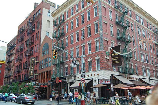
It is common to think of New York City as a place where things are transient. People come and go, businesses come and go, buildings come and go. However, there is a lot more permanence to the Big Apple than perhaps some folks realize. This isn't due strictly to preservation laws, either, though they certainly contribute. Instead, there is an institutional orderliness in Manhattan which maintains places that serve a need. A business doesn't have to be particularly unique - it may just be another local diner or steakhouse or deli when it opens. However, some of them have that special ingredient that stands the test of time. This isn't a judgment call or a review or anything like that, it is simply fact: some joints last seemingly forever while most are gone within a few years. One of the lasting places is the Ferrara Bakery at 195 Grand Street between Mulberry & Mott Streets.

I came across the above old photo of the Ferrara Bakery from the 1970s and became curious about what the site looks like today. So, I went on Google Street View and did a comparison of Ferrara Bakery between the 1970s and the 2010s. The resulting recent photo is below.

A little research soon showed me that Ferrara Bakery was established in 1892. That doesn't make it the oldest local business in Manhattan by far, as there are restaurants such as The Old Homestead Steakhouse and Kenn's Steakhouse that originated in the mid-1880s that I can think off the top of my head that are older (and I would place good odds on some other businesses being older than them, too). The old joints all play up their venerable status one way or another - if they can't claim to be the "oldest," then they are the "best known." Nothing wrong with that - as the Jack Nicholson character said in "Terms of Endearment," we all use what we can.

Ferrara's claim to fame, aside from being around since before anyone alive today was born, is that it remains in the same family after five generations. It claims to be the first Pasteria and Espresso bar in "America." I'm not even sure what a Pasteria is - I'm sure it sells pasta, but only pasta? - but I'll believe them. Who's going to check? In any event, they've been doing something right, that's for sure.

Antonio Ferrara and Enrico Scoppa opened Café A. Ferrara in 1892. That section of Grand Street is in the heart of Little Italy. So, location, location, location being the first rule of real estate, placing your Italian bakery right in the heart of what has become a venerable institution within New York City devoted to your restaurant's tradition was either serendipitous or extremely shrewd planning. Ferrara's now is surrounded by other Italian bakeries and similar joints, of course, but there's only one Ferrara Bakery. The area gets a lot of foot traffic from tourists and locals alike, and that's exactly what a bakery needs to survive. People who want to see Little Italy because everyone knows about Little Italy are going to stroll by, see something nice in Ferrara's window, and stop in Why not? It's an authentic piece of Little Italy and the immigrant experience.

A comparison of the 1970s photo with the more recent one shows that little has changed in 40+ years. The Ferrara sign appears to be the same, as does its building - although the facade has been drastically updated. Call me a traditionalist, but I preferred the original facade. It's probably a lot nicer inside now, though.

Ferrara Bakery Little Italy randommusings.filminspector.com
Stepping back a bit, this photo shows Ferrara Bakery in perspective. I still don't like that new facade. Looks like they change the bushes out front with some regularity.

The other buildings on the block also are the same. Getting anything changed on that street probably requires multiple approves from people who have no interest in seeing a historic area change, so that is not too surprising. Ferrara's must have had some pull to get their renovation permits approved.

Overall, the area looks a bit classier than it did in the 1970s. Gone are the low-rent sandwich shops and so forth. Now there are perfectly manicured potted plants out front and everything looks nice and tidy. The fire escapes are still there to give the area that authentic look of the Lower East Side. There has been some change, but it has been subtle and tasteful - just like Ferrara's mini cannoli.

Anyway, I hope you enjoyed this entry in my "the more things change the more they stay the same" series. Check out my other offerings, I love looking at how neighborhoods change - and don't change - over time.

Ferrara Bakery Little Italy randommusings.filminspector.com
Ferrara Bakery on Grand Street in the 2010s (Google Street View).
2018

Tuesday, November 20, 2018

Then and Now: Keen's Chop House, Manhattan

Then and Now: Keen's Chop House, Manhattan

Keen's Chop House on West 36th Street 1976 randommusings.filminspector.com
Keen's Chop House, 1976 (Chris Protopapas).

Chris Protopapas, a Greek immigrant, began taking photographs of ordinary street scenes in New York City in 1974. He took the above photo of Keen's Chop House at 72 W 36th St, New York, NY 10018 in 1976. It's an interesting composition with the Empire State Building looming in the background - which was likely why he took the shot - so I became intrigued. I decided to do this comparison of Keen's Chop House from 1976 to the 2010s and see what the location looked like now.

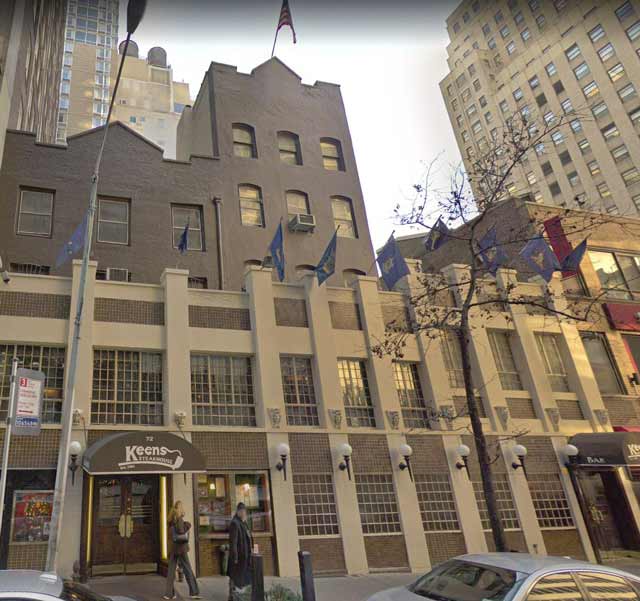
Well, my research quickly showed that Keen's Chop House remains very much in business. In fact, the entire block looks the same, as you can see in the Google Street View photo of the same area in the 2010s. None of the buildings on the block has been replaced, though their facades have been subtly altered in places. This is one of the most unchanged blocks I've found in midtown, in fact.

You know, of course, that the Empire State Building is still there. Unfortunately for our comparison picture, a building on 35th Street now blocks it from our vantage point at the intersection of 36th Street and Sixth Avenue. However, if you look very carefully at the photo at the bottom, you can just see the very tip of the Empire State Building's television mast just above the intersection of the two buildings in the background. A building has to be tall to be able to have any part of it still be spotted from this extreme angle above those tall buildings. If you were unfamiliar with the area, however, you'd never even notice it until you walked down the block and saw its massive presence.

Keen's Chop House on West 36th Street 1976 randommusings.filminspector.com
Keen's Chop House (Google Street View).

Keen's (now called Keen's Steakhouse because the term "Chop House" has gone out of style) opened in 1885. That was the golden age of steak restaurants, places for the wealthy. Lüchow's on 14th Street was another well-known example. While Lüchow's closed in 1984 and its building was demolished in 1995, Keen's survives pretty much exactly as it was decades ago. It has become a tourist attraction in its own right, boasting 90,000 clay pipes which it calls the largest such collection in the world.

Other than Keen's, the entire block seems like it is caught in a time warp. The street lamps, one of which you can clearly see in the 1976 photo but which is obscured by the dark background in the photo below, are still the same. The fire escape on the 5 Boro Burger building at 80 West 36th Street is still there, none the worse for wear after more than 40 years, though they have removed the little ornamental cornice on that building probably because it deteriorated with time and became a hazard.

Anyway, thank you for visiting this installment of this series showing that "the more things change, the more they stay the same." I hope you enjoy these little history excursions as much as I do putting them together!

Keen's Chop House on West 36th Street 1976 randommusings.filminspector.com
The same vantage point of Keen's Steakhouse on West 36th Street, Manhattan today (Google Street View).

2018

Then and Now: City Diner on West 23rd Street, Manhattan

Then and Now: City Diner at 163 West 23rd Street, New York City

City Diner Malibu Diner 163 West 23rd Street randommusings.filminspector.com
City Diner at 163 West 23rd Street, Manhattan around 1980.

When you live in the city, little joints that the world seems not to notice loom large. If you find a good local diner, for instance, you treasure it. You get to know the workers, they get to know your name, you learn what days they have certain specials, little oddities like whether they sell cheap bagels at 8 a.m. on every other Thursday - that sort of thing. Then they move, or you move or you lose track. Well, let's make a comparison of City Dinner at 163 West 23rd Street, Manhattan from the 1980s to the 2010s and see what happened to that location.

I never know what happened to a particular location before I start researching it. It could be completely different, with no remaining reference points at all. However, although City Dinner is no longer at 163 West 23rd Street, the spot hasn't changed much at all in the intervening decades. While you may be wondering what is so special about some old diner, there's a hidden story to City Diner that you may find as interesting as I did.

City diner opened around 1978 in a brick building that had once been home to the Traffic Cafeteria (the building still bears the name). It became the Malibu Diner in 1981, though ownership appears to have remained either unchanged or little disturbed. So, as of this writing, Malibu Diner has been there for four decades. That's enough time to build up a wealth of expertise in how to please your customers.

City Diner Malibu Diner 163 West 23rd Street randommusings.filminspector.com
Malibu Diner in New York. (Photo by Malibu Diner Facebook page).

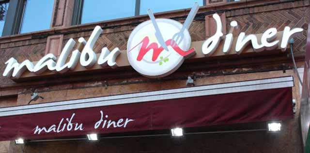
As shown in the photo below taken from Google Street View, City Diner at 163 West 23rd Street is long gone. However, what has taken its place? Why, another diner, of course. This one is called Malibu Diner. Or is it another diner, or the same City Diner with a new name? We shall soon find out.

Malibu Diner is open 24/7 and generally gets good reviews. Do you want water in a glass instead of a cup? The Malibu Diner is your place. People call it a "slice of old-time New York," and our comparison shows that isn't far off the mark. The Malibu Diner is one of those places where you go to get a classic tuna melt, or maybe a Bison Burger Deluxe. Nobody will make it exactly like one of those joints, which have been perfecting their craft literally for decades - as we can see. Oh, and it also delivers - you can't beat that!

Oh, the Malibu Diner is a Greek Diner, though many of the workers there now apparently are Spanish speakers. Why the owners decided to change the name to "Malibu Diner" is a bit of a mystery. In the recent photo below, you can see the entrance to 165 West 23rd Street to the left of the diner (this is on the north side of 23rd Street). The City Diner building facade doesn't appear to have been touched in the 40-odd years since the above photo from around 1978-1980 was taken. They have added an awning - well, you do have to make some concessions to the passage of time. I think the awning gives the diner a classier look, but City Diner looked just fine without it, too.

Selis Manor and Malibu Diner 163 West 23rd Street randommusings.filminspector.com
The view from Selis Manor, at the right, to Malibu Diner at the left (marked by the red canopy). Google Street View.

One of the secrets to why City Diner/Malibu Diner has survived is that it has a devoted clientele at nearby Selis Manor. Selis Manor is a 200-apartment building that offers special housing for the blind. Selis Manor, founded by a blind newspaperman, opened in 1980. You might notice the timing. This was right after City Diner opened, and the owners of City Diner recognized a community need that needed to be filled. Many of the visually impaired folks have difficulty chopping up their food, so they simply come down to the Malibu Diner or order delivery. Malibu Diner always plays music outside so its visually impaired patrons know that they've arrived. Malibu Diner features menus in Braille - how often are you going to find that? My friends, there's a secret to every successful business, and you just learned Malibu Diner's secret.

Anyway, I hope you enjoyed this entry in "the more things change, the more they stay the same." There are lessons in the success of the Malibu Diner that wise readers will appreciate. Thanks for stopping by!

City Diner Malibu Diner 163 West 23rd Street randommusings.filminspector.com
163 West 23rd Street, Manhattan in the 2010s (Google Steet View).

2018

Then and Now: Christopher Street at the West Side Highway, Manhattan

Then and Now: Christopher Street at the West Side Highway, New York City

Christopher Street at the West Side Highway, Manhattan randommusings.filminspector.com
Christopher Street at the West Side Highway, the mid-1970s.

I stumbled across this photo that appears to be from the 1970s. The World Trade Center appears to be completed, which puts us after roughly 4 April 1973. The West Side Elevated Highway is still intact, and that was torn down between the spring and fall of 1981. So, we are somewhere between 1973 and 1981, and the cars look as though they belong in the mid-1970s to me. I decided to do a comparison of Christopher Street at the West Side Highway between the mid-1970s and 2018.

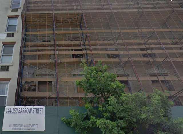
The first thing to do is to make sure that we're located in the right place, the southern corner of Christopher Street as it exits toward the West Side Elevated Highway. Notice the building to the left of the young lady riding her bicycle. It has distinctive window cornices. Well, a close-up of the facade of that building, directly below, reveals that building to be 144-150 Barrow Street, which was being renovated when the Google vehicle rolled by. So, we have a positive match.

Christopher Street at the West Side Highway, Manhattan randommusings.filminspector.com
144-150 Barrow Street recently (Google Street View).

Just to orient anyone unfamiliar with the area, here is a photo of the same location looking due west - the direction that the lady on the bicycle is riding. In the 1970s, though, she would not have had this view. The view to the river would have been completely blocked by the elevated highway except between the girders. You can see Hoboken across the river in the below picture quite clearly.

Christopher Street at the West Side Highway, Manhattan randommusings.filminspector.com


It appears from the current site of the 1970s photo, below, that the other buildings are the same, too, though it's tough to verify that the building to the left of the one with the window cornices is the same - it probably is, but with a new facade. New York City preservation laws protect these run-down old buildings, else they would all be replaced by high-rises.

The most distinctive changes, of course, are the replacement of the World Trade Center with the One World Trade Center Freedom Tower and the removal of the elevated highway. I bet nobody in the 1970s would have thought that the brand-new World Trade Center would be long gone by 2018, but things happen. Of course, everyone gets sentimental about the horrific tragedy of 9/11 and all the deaths that occurred then. Purely from an aesthetics point of view, the Freedom Tower is an improvement over the bulky World Trade Center in my very humble opinion. I'm sure many prefer the look of the old WTC, and, obviously, the tragic cost of having to replace the original was a price nobody would ever want to pay willingly. But, you make the best of a bad situation and move on, that's the story of the Big Apple and this particular street corner.

This area has been the subject of fierce controversy over the years. The initial thought was to build Westway. The highway would have been placed well to the right of where it is now, with the entire waterfront filled in with concrete and new buildings. Given the huge preservation effort in the city which protects how things are, however, Westway never had a chance. So, what resulted was the rather inefficient highway shown below which effectively cuts the waterfront off from civilization. There really was no perfect solution, but at least there isn't a hulking steel mountain in place which blocks off access and the views of the Hudson and New Jersey.

The area is much nicer now. Notice the worn streets of the 1970s, which cars would rumble across and which tested their shocks. Those streets were a lot more common back in the day and gave the area a distinctive character. Now, everything is smoothly paved just like everywhere else in the city.

One other major change is the presence of trees in the photo below. Back in the 1970s, it was rare to find trees outside of the various parks, and the trees that were there were usually sad specimens. The trees give the area color and vitality that was completely absent in the stark concrete jungle of the 1970s. However, the basic idea is completely unchanged: using the city's edges to move traffic. That will probably never change, it's just too convenient even if it decapitates the shoreline and turns it into an afterthought to life in the city.

Thanks for stopping by for this latest in my series of "the more things change, the more they stay the same." I hope you find it as interesting as I do in preparing it!

Christopher Street at the West Side Highway, Manhattan randommusings.filminspector.com
Christopher Street at the West Side Highway, the mid-1970s (Google Street View).

2018

Saturday, November 10, 2018

Then and Now: Broadway at 48th Street, Manhattan


Then and Now: Broadway at 48th Street, Manhattan

Broadway at 48th Street in the 1970s randommusings.filminspector.com
A 1970s postcard showing the old Ramada Inn location at 48th Street and Broadway in Manhattan.

I came across the above hotel postcard from the 1970s and noticed something oddly familiar about it. I looked closer and then looked at the description on the back of the card and it hit me: Wienerwald!

Yes, that's a green Wienerwald sign on the front of this Ramada Inn card. Anyone who has been following this blog knows that in two previous posts I have identified two Wienerwald locations: at Broadway and 51st Street and in Times Square at 51st Street. It also turns out that there was a third Wienerwald location, and here it is shown in the postcard: at 790 Eighth Avenue at 48th Street.

Broadway at 48th Street in the 1970s randommusings.filminspector.com
This blurb from the 26 May 1980 New York magazine was my Rosetta Stone in unlocking the locations of the three New York City Wienerwald Restaurants.

What is Wienerwald? It is a chain of Austrian chicken restaurants. Yes, it says "Wiener" in the name, but the restaurant, as far as I know, did not, in fact, serve wieners. It was just an early chain franchise restaurant, founded in 1950, that was vaguely along the lines of KFC and served chicken. At its height in 1982, Wienerwald had 880 or so locations in the United States, but that is when it filed for bankruptcy protection and shuttered all of its United States restaurants. It was a cautionary tale in expanding too far and too fast and getting overstretched. Wienerwald still exists in its native Austria but is long gone from the United States. The word "Wienerwald," incidentally, has nothing at all to do with wieners and actually means "Vienna Woods."

Having identified the location of the last Wienerwald, I decided to do a comparison of Broadway at 48th Street from the 1970s to the present day. I am fascinated by the business strategy of placing three franchise locations in Manhattan within a few blocks of each other as if Time Square was the only suitable restaurant location in the entirety of New York City. The local Wienerwald subsidiary was formed using this address in 1970, and it went inactive in 1993.

The 48th Street Wienerwald was located in the Hilton Garden Inn Times Square, which apparently was a Ramada Inn at that time. It was located at 790 Eighth Avenue, New York, New York. The building was erected in 1962, has 14 stories, and is still there. I have placed below a recent shot taken from Google Street View of the building from approximately the same orientation as the postcard.

Broadway at 48th Street in the 1970s randommusings.filminspector.com
A view of the Broadway at 48th Street location in Manhattan taken in 2018 (Google Street View).

As can be seen from the comparison, very little has changed at the corner of 48th Street and 8th Avenue from the 1970s to 2018. The Wienerwald location has become a touristy gift store, while the hotel remains in use as a hotel. There now is a large tree out front of the old Wienerwald location, part of a long-term New York City project to inject some greenery into the city. The site is a testament to how little actually changes in New York decade after decade. The same building, properly maintained, will likely be there for another 50 years, and, while the Wienerwald Restaurants of the world will come and go, the ground-level stores will continue to cater to the needs of visitors.

Thank you for visiting this entry in my "the more things change, the more they stay the same" series on the evolution of street scenes.

Broadway at 48th Street in the 1970s randommusings.filminspector.com
A view of the Broadway at 48th Street location in Manhattan taken in 2018 (Google Street View).

I also have pages for the other Wienerwald locations in New York City, there were three in all:
Why were they so closely bunched together? You'd have to ask them. But, there likely was enough foot traffic in the area to sustain them, so why not?

2018

Friday, November 9, 2018

Then and Now: Wienerwald at Broadway and 51st Street, Manhattan


Then and Now: Wienerwald at Broadway and 51st Street, Manhattan

Wienerwald Broadway 51st Street randommusings.filminspector.com
Broadway at 51st Street circa. 1980.

I found the above photo of the corner of Broadway and 51st Street in Manhattan from the 1970s or early 1980s and decided to investigate to see how the corner looks now. So, I did a comparison of the corner of 51st Street and Broadway in Manhattan from around 1980 to 2018. I took a photo from Google Street View below for the current view of the corner.

I actually had all sorts of trouble pinpointing the location in this photo. The only thing that stands out in the photo is the Wienerwald location on the corner at 1650 Broadway. My sources said that there was a Wienerwald on 790 Eighth Avenue at 48th Street, but I could not get that intersection to line up with the above photo. Finally, I got frustrated and did a little more research, which is always a good idea in such situations. I finally pieced everything together when I found the following item in New York magazine from 26 May 1980.

Wienerwald Broadway 51st Street randommusings.filminspector.com
New York Magazine, 26 May 1980, page 115.

So, as you can see from the New York magazine entry, there were not two Wienerwald restaurants in the Times Square area back in the 1970s and early 1980s - there were instead three Wienerwald restaurants. It had not occurred to me that a German company would place three locations literally within a few blocks of each other where they would cannibalize each other's business, but such was the case.

The below photo of the southeast corner of 51st Street at Broadway from Google Street View does line up, though a lot has changed in the intervening years. The best indication that this is the same street corner as in the above photo from ca. 1980 is the presence of the windows above where the Wienerwald restaurant. Some of the buildings in the background are the same, too, but they aren't distinctive enough to really draw any conclusions. The locations do match up.

Wienerwald was an Austrian restaurant chain, one of the earliest, that was formed in 1950 and accumulated 880 locations by the time of its bankruptcy in 1982. It did not serve wieners, but instead served chicken - the name actually means "Vienna Woods." Why you would name a chain of restaurants in the United States with such a misleading name is unclear, but the chain did have some success before McDonald's and other US fast food joints, er, ate its lunch. Wienerwald remains in existence in its home country, with about eight locations, but it was forced to shutter its US locations in 1982. The main location for the New York City restaurants was at the 48th Street location, where the corporation had its subsidiary based. That corporation has been "inactive" since 1993.

Now, the location serves as the home of Ellen's Stardust Diner. People have to eat, and this busy location still serves that basic need. The more things change the more they stay the same.

Thanks for visiting this entry in my review of historical street photos and how they look now. I hope you enjoy them!

Wienerwald Broadway 51st Street randommusings.filminspector.com
A photo of the southeastern corner of 51st Street and Broadway ca. 2018 (Google Street View).

I also have pages for the other Wienerwald locations in New York City, there were three in all:
Why were they so closely bunched together? You'd have to ask them. But, there likely was enough foot traffic in the area to sustain them, so why not?

2018

Wednesday, November 7, 2018

Then and Now: Wienerwald in Times Square, Manhattan


Then and Now: Wienerwald in Times Square

7th Avenue Times Square 1975 randommusings.filminspection.com
1560 Seventh Avenue in Manhattan, New York in the spring of 1975 (Nick DeWolf).

Times Square in New York City is one of the busiest pieces of real estate in the world. It is known as the "Crossroads of the world," among other things. You might think that it is constantly changing from year to year to keep up with the cutting-edge of cultural shifts. Well, I found the above 1975 photo of 1560 Times Square, an address located on the east side of 7th Avenue between 46th and 47th Streets, and grew curious about what it looks like now. So, I did a comparison of 1560 Seventh Avenue in Manhattan from Spring 1975 to 2018. I used Google Street View for the most recent shot below.

We can pinpoint the exact location due to the Embassy Theater (aka Embassy 1 Theater) which is at the extreme left of the 1975 shot (it is showing Irwin Allen's "Earthquake"). The Embassy closed in 1997 and, after renovation, was reopened in 1998 as the Times Square Visitor Center (retaining its iconic marquee). One of the most noticeable parts of the 1975 photo is the big green Wienerwald sign. Wienerwald ("Vienna Woods" in German) was a large (860 restaurants) chain of Austrian chicken restaurants (no, not wieners as you might have thought, which may have contributed to some of its difficulties in the United States). Wienerwald continued at this location until roughly 1982, when the company filed for bankruptcy. As part of its reorganization, Wienerwald closed all of its American restaurants (some Wienerwald restaurants continue in Austria).

Well, people have to eat, so another restaurant moved into the old Wienerwald spot. It didn't serve chicken, except on sandwiches.

7th Avenue Times Square 2013 randommusings.filminspection.com
This shot of the old Wienerwald site was taken 28 December 2013 (Paul Rudoff).

Yes, McDonald's took over the Wienerwald location around 1984 and has been there ever since. There is a certain irony to this since the growth of the US fast food franchise industry is part of the reason why Wienerwald itself closed its store in the United States. This location at 1560 Seventh Avenue is a fairly famous spot. It was in Bobby Brown's music video for his song "On Our Town," for instance. Of course, any time a film shows someone traveling through Times Square it is likely to give a glimpse of the spot. As shown in the Google Street View shot below, the McDonalds itself has become somewhat of an institution in Times Square.

This just shows that the more things change, the more they stay the same. A good location for a food establishment is always going to be one so long as the area remains popular, and Times Square continues to attract visitors from around the world. It's would probably be a bit of a let-down for German tourists to wind up eating at a Wienerwald in Times Square, so maybe a more American-themed restaurant in that spot is for the best.

Anyway, thanks for visiting, and I hope you enjoyed this brief excursion back into the history of Times Square as much as I did.

7th Avenue Times Square 2018 randommusings.filminspection.com
1560 Seventh Avenue in Times Square, Manhattan ca. 2018 (Google Street View).

I also have pages for the other Wienerwald locations in New York City, there were three in all:
Why were they so closely bunched together? You'd have to ask them. But, there likely was enough foot traffic in the area to sustain them, so why not?

2018

Then and Now: East 149th Street at Prospect Avenue, South Bronx


Then and Now: East 149th Street at Prospect Avenue, Bronx

East_149th_Street_Bronx_randommusings.filminspector.com
The Northwest corner of East 149th Street at Prospect Avenue, Bronx, in 1980.

The South Bronx is an interesting place for urban explorers because so much of it remains untouched for decade after decade. The reasons for this are multiple, but boil down to lack of investment in new buildings. This, in turn, derives from the lack of lack of popularity of the area to what we might call "outsiders." The above picture from the South Bronx in 1980 piqued my interest, so I decided to compare the Northwest corner of East 149th Street at Prospect Avenue in the Bronx from 1980 to 2018. To do this, I took a current grab from Google Street View, which is below.

As the above photo from 1980 shows, the South Bronx in 1980 was a gritty place. It is a stark view, an endless expanse of concrete with some tenements and some strip mall-type buildings on the street. Citibank has a branch there, looking remarkably like a fortress with thick walls and a stark paint job. Overall, it is a forbidding landscape, which in all fairness may have something to do with when the photo was taken. However, it does not look like a very welcoming place, and, unless you have some banking to do, not the type of area that you would want to tarry in for any length of time.

East_149th_Street_Bronx_randommusings.filminspector.com
The Northwest corner of East 149th Street at Prospect Avenue, Bronx, in 1992.

A picture of the same corner at East 149th Street at Prospect Avenue, Bronx, in 1992 shows that little had changed other than the tenants of the buildings. In a sign of the times, the Citibank branch had become a video store. Everyone wanted to own a video store in the late '80s and early '90s, it was the "hot thing." It looks like pretty much everything else is unchanged from 1980. The buildings down the street to the right are still there, and the billboards are still in use. The billboards are evocative of the era but do give the neighborhood a somewhat junky feel. There is a small tree down the block which breaks the starkness a bit.

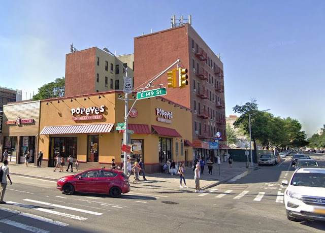
In the photo below from a recent Google Street View map, Most of the buildings appear to be the same. The tenements certainly are still there, and it appears that the Citibank building has simply been converted into a Popeye's restaurant. The street lights look pretty much the same, as do the street signs on the pole. There are no billboards anymore. The buildings behind the tenements are gone, but, otherwise, the photo shows how little has really changed at this particular corner. The replacement of the Citibank with a video store and then a fast food joint pretty much mirrors the transition of the city, as many now complain that the only stores you find anymore are fast food joints and similar high-traffic businesses that provide mundane conveniences.

There is one subtle change in the most recent photo, however, that makes a big difference. The small tree in the 1992 photo now makes a big impact in the photo below. In fact, there isn't any suggestion of any living thing at all in the 1980 photo, and the tree in the 1992 photo is almost inconsequential. Comparing the 1980 photo with the more recent one shows how much some greenery softens a landscape that otherwise looks harsh and forbidding. The city has made that change in many locations, and it greatly improves the quality of life of those that live there. The streets and buildings may be the same, but the little touches make all the difference.

Anyway, thank you for visiting this installment of my "the more things change, the more they stay the same" series. I hope you enjoy history as much as I do!

East_149th_Street_Bronx_randommusings.filminspector.com
The Northwest corner of East 149th Street at Prospect Avenue, Bronx, ca. 2018 (Google Street View).

2018

Sunday, November 4, 2018

Then and Now: Carmine's at South Street Seaport, Manhattan


Then and Now: Carmine's

Carmine's randommusings.filminspector.com
Beekman and Front Street, 1982.

The South Street Seaport is a historic old gent that became a theme park for the tourists long ago, but there is some real history there which is withering away. The above photograph that was taken in 1982 on Beekman and Front Streets captured some of that fleeting history. I decided to compare the change over the years at Beekman Street and Front Street from 1982 to 2018. I took a picture from Google Street View below to show the change.

The unidentified gentleman hauling the hand truck is engaged in hauling some fish from the Fulton Fish Market to one of the local establishments - perhaps Carmine's Bar and Grill in the background. The very authentic cobblestones under his feet appear rougher back in the day than they are now, undoubtedly smoothed over during the area's redevelopment because the tourists don't like a bumpy ride. You want it authentic - but not too authentic, if you know what I mean.

As shown, Carmine's was at the corner at 140 Beekman Street and Front Street. There are several "Carmine's" in New York City, all of them claiming with some legitimacy to be "the" Carmine's, but this Carmine's was the "real one." Founded in 1903, Carmine's was the oldest restaurant in the South Street Seaport until its closing after a grand 107 years on 30 June 2010. While you might think that the 2009 recession caused its closing, the recession actually had nothing to do with it. Instead, it was the same old story that closed Florent in the Meatpacking District countless other famous eateries. The landlord simply jacked up the rent too high and that's all she wrote. In New York City, not only do you have to provide a valuable service and establish a clientele, but you also have to withstand constantly rising rents and landlord "opportunity costs." It's a tough task that takes out some of the best old restaurants and replaces them with nail salons, dry cleaners, and chain coffee shops.

Carmine's randommusings.filminspector.com


While you would think, being at the Seaport, that Carmine's was most famous for its seafood, that' not quite true. In fact, patrons loved Carmine's for its Italian food - which admittedly often involved fish of some kind. When you go to those old joints that have been there since before your grandpappy was born and order "authentic" seafood, be forewarned: it often isn't that tasty dish that you were expecting. I ordered "original" clam chowder once at the Seaport and it sure was authentic. It also sure was practically inedible for my untutored palate, which is a reflection on me and not the dish, but there you have it. I manfully ate it anyway, grimacing at the strange spices. Anyway, Carmine's was a classic old waterfront hole in the wall that anyone who ate at one in the Seaport back in the day would recognize. It had all the trimmings: the polished dark wooden bar, dark wooden booths, the inevitable seafood decor of nets and life preservers and so forth, mature waitresses who had been there since World War II - you get the drill.

The local cops and dockworkers would hang out there, so you know it had to be good. Really if you want to find the best places in town, good and cheap, ask around for where the firemen or the EMTs eat. You'll usually wind up with a great experience.

Carmine's randommusings.filminspector.com


In 1982, the year the picture was taken, the Seaport's prospects improved - for tourists, anyway - when redevelopment began to turn South Street Seaport into the theme park that it is today. Prior to that, the Seaport was simply a working seaport, with the overpowering smell of fish from nearby Fulton Fish Market always in the air (Fulton finally left in 2005). There would usually be a big pile of fish or, well, something resembling fish in front of the Fish Market in the morning, and that was the time of day to close the car windows as you drove by. In the 1970s, it was a place where you didn't want to really spend much time, where you just assumed "deals" were taking place under the FDR and the cops liked to park. We drove through often, never stopped - as George Bush might have said, wouldn't be prudent.

These days, in my very humble opinion, the only reason to go to the Seaport is the mall, where you can grab a bite or a drink and then go out and sit for free on the terrace with fabulous views of the Brooklyn Bridge and the East River. The Seaport's owner - yes, it's the Howard Hughes Corporation - recently replaced the mall with another mall And one mall begat another mall...

The owner of Carmine's made noises for a while about reopening the restaurant somewhere else, but that almost never happens, and it didn't this time, either. He finally admitted Carmine's was gone for good in 2011. Now occupied by Vbar Seaport, a generic Italian eatery perfect for the tourists, the building is the same (minus the classic old Carmine's signage). There's still an Italian restaurant there, but the locals miss their Carmine's.

I hope you enjoyed this little stroll into the past and back into the present.  The more things change, the more they stay the same, and that's the story of Carmine's at the South Street Seaport.

Carmine's randommusings.filminspector.com
The old Carmine's location ca. 2018 (Google Street View).

2018

Saturday, November 3, 2018

Then and Now: Florent on North Gansevoort Street, Manhattan


Then and Now: Florent Diner, Meatpacking District, Manhattan

Florent randommusings.filminspector.com
R&L Lunch ca. 1938, when it opened.

The above photo of the R&L Luncheonette at 69 Gansevoort Street in the Meatpacking District stirred some memories for me. So, I decided to do a comparison of the R&L Luncheonette aka Florent's from 1938 to 2018. I grabbed an image from Google Street View below for the comparison.

Located at 69 Gansevoort Street, which is one of the more obscure streets in one of the more obscure sections of Manhattan, the R&L was a stalwart in a rapidly changing neighborhood. The High Line, now a park, was still operating when the R&L opened, bringing in frozen turkey and beef for the meatpacking operations around the corner. It wasn't much to look at - just a joint, in the middle of the block with a Formica counter running down the left side. There couldn't have been more than a dozen tables (the certificate of occupancy provided for 74), all squeezed together with those plastic chairs that you thought hadn't escaped the 1960s. It was hard to find and harder to find in the dark in an area that was not exactly the safest in the area. You were quite likely to pass more than one streetwalker on the way of indeterminate gender.

For all that, the R&L did great business. It stayed open 24 hours a day seven days a week and was a favorite spot of the nearby workers. It easily could have closed in the 1980s as the neighborhood changed into a center of the New York gay scene, but openly gay French cook Florent Morellet, who had failed at his previous restaurant, took it over in 1985. That began the last, and greatest, phase of the R&L, which Morellet renamed Florent. Morellet had given his father, conceptual artist François Morellet, a party at the Brooklyn Museum, and while in town spent some time in the meatpacking district. At that time, the area had clubs like Hellfire, Anvil, Mineshaft... you get the picture. The area was alive throughout the night because of the meatpackers, with trucks lined up at 2 a.m. to deliver their sausage and beef slabs. Everyone had money to spend with few nearby places to spend it, and they were hungry.

Florent randommusings.filminspector.com
The sign in the front window which told you that you had finally found the right place in the darkness.

Florent signed a ten-year lease for $1350 a month with the family of the original owner and opened his restaurant in August 1985. He kept the original sign and furnishings and got his liquor license in 1969. Florent gave both the meatpackers and the club kids what they wanted. Roy Lichtenstein ate there all the time, but many other celebrities did, too, as there was a major recording studio nearby. If you wanted onion soup at 3:35 in the morning, you headed to Florent. It served the standard diner food mixed in with a French touch: mussels, pâté, steak frites, hamburgers, cheeseburgers. The eggs were a great choice for brunch with a side order of fries and some black coffee on a cold January morning. The payphone near the front door got a workout, as did the cigaret machine - $1 a pack for Marlboros back in the day. There were unusual events that you didn't expect anywhere north of Fire Island, such as the annual Bastille Day drag party. It was what it was, either that atmosphere was to your taste or it wasn't. If you frequented Tea Time at The Pines and lived in the Village with an occasional trip out to the Hamptons on the jitney, you felt right at home at Florent. Florent was good people, as we used to say.

Florent randommusings.filminspector.com
Florent at the end.

Well, as you can see from the below picture, Florent is gone. A harbinger of doom was when Florent instituted a children's menu due to the influx of Yuppies. It closed 29 June 2008, a true victim of gentrification when the landlord raised the monthly rent to $30,000 (and who, it turned out, wanted to open their own restaurant). I was fortunate to patronize Florent before it closed - it seemed eternal, because it was always busy and who else would want to run a place in that dingy area? But the entire area has changed - Hogs & Heifers around the corner is long gone, too - and now the Meatpacking District is full of fancy boutiques and chic restaurants. Community Board 2 has been very picky about tenants there, and there have been several since Florent closed.

Florent randommusings.filminspector.com
The "For Rent" sign after Florent closed.

But one thing - the facade of the R&L Diner - remains. Oh, and Florent Morellet? He moved to Bushwick. The rumor is that Showtime is developing a series about Morellet. Whether anything actually comes of that, who knows, but it shows that Florent is gone but not forgotten.

Anyway, thanks for visiting this page of my "the more things change, the more they stay the same" series. I hope you find them interesting!

Florent randommusings.filminspector.com
The R&L ca. 2018, now a clothing boutique. The owners have maintained the traditional facade and red neon light in the front window (Google Street View).

2018

Then and Now: Canal Street at Broadway, Manhattan, NYC


Then and Now: Canal Street at Broadway, Manhattan

Canal Street and Broadway NYC in 1984 randommusings.filminspector.com
Canal Street at Broadway, Manhattan, 1984.

Late-night hangouts are one of the prime attractions of New York City. If you find one, you tend to keep going back because they tend to draw the same kind of crowd over and over. You don't get many tourist buses pulling at 4:15 a.m. One of the best was Dave's Corner Luncheonette at the southeast corner of Broadway and Canal Street. I decided to do this comparison of the above 1984 photo with its appearance in 2018. The recent shot below is from Google Street View.

One can see from the photos, the buildings, street lamp, and pretty much everything else are unchanged despite the passage of over three decades. The building on the corner has been prettied-up a bit, and Dave's has been replaced with an Asian restaurant. The buildings in the background are the same, and the entire area looks pretty similar. Dave's had one of the best locations in the city for a diner since it sat at the crossroads of Chinatown, SoHo, the East Village, and you could hop on the subway uptown and stop at Dave's on the way home to Brooklyn via the convenient subway stop right outside. on Canal.

Canal Street and Broadway NYC in 1984 randommusings.filminspector.com
The same corner at night. This is how a lot of patrons will remember it best.

Dave’s Corner Luncheonette was just outside the SoHo Broadway district. While there are plenty of great restaurants, they aren't all open 24 hours. While there are a lot of empty streets at that hour, places like Dave's are always busy. Patrons at the nearby Mudd Club would stop by for fries, while truck drivers would get a late dinner or early breakfast before heading back out of town. Everyone loved the three horseshoe-shaped lunch counters where little groups would congregate and get some espresso to keep on going through the night. "You Ring/We Bring" said the sign at the cash register. A lot of deals went down at Dave's in the middle of the night, as the clientele respected the entire spectrum of the area, which in those days was more blue-collar and artistic, but also included its share of young white-collar office dwellers. Cabbies would stop by during their shift for some quick coffee. Dave's had great egg creams, cherry cokes, cherry-lime rickeys, and other NYC specialties.

One of the assets of Dave's was the older waiters and waitresses. It was like having your mom bringing your coffee and indicating her opinion of your personal sugar-and-cream preferences with a toss of her head. Sure, you could go somewhere else and have an indifferent college student bring you your order, but it was considered a sign of class to have the older servers. And, Dave's had class. It closed around 1990 and is sorely missed.

Canal Street and Broadway NYC in the 1950s randommusings.filminspector.com
A view of the same corner from the northeast, apparently in the 1950s. The National City Bank building in the center of the photo is still there.

There were only so many after-hours places in Manhattan. Coffee Shop on Union Square (that's the name, it was a trendy restaurant/bar and not actually a coffee shop) and Florent in the Meatpacking District were my personal favorites, but there were many scattered across the landscape. If you spent enough time in Manhattan, you eventually found out where they were and went back. And back. And back again. Because a good late-night place was one of the true delights of living in the city.

Canal Street and Broadway NYC randommusings.filminspector.com
The view from the northast, as in the preceding photo (Google Street View).

Anyway, times change, but the more things change, the more they stay the same. People still have to eat, so there's another restaurant on that corner and a food truck out front. Back in the day, Dave's took care of all that by itself.

Canal Street and Broadway NYC in 2018 randommusings.filminspector.com
Canal Street at Broadway, Manhattan, ca. 2018 (Google Street View).

2018

Then and Now: East Burnside Avenue, The Bronx


Then and Now: Burnside Avenue at Valentine Avenue, the Bronx

Burnside Avenue the Bronx randommusings.filminspector.com
Burnside Avenue near Valentine Avenue, the Bronx, mid-1970s.

In this episode of our journey, we are venturing a bit outside Manhattan for a change. The above picture of Burnside Avenue near Valentine Ave in the Bronx, taken in the mid-1970s, caught my eye. Primarily, this was because of the looming presence of 2000 Valentine Avenue, "Twin Parks South West" in the distance. I figured that such an imposing edifice might stir some gentrification in the area over the course of a few decades. Why not - much of the rest of the city has changed for the better, so why not this area? Thus, I compared Burnside Avenue at Valentine Avenue in the Tremont section of the Bronx in the 1970s with the same area in 2018.

My initial impression that there would be some local improvement due to the building of Twin Parks Southwest in 1973 was not really borne out by my research. A quick look at the recent photo taken from Google Street View at the bottom of the page shows a few improvements in the area, but not many. Twin Parks South West (Valentine Avenue runs directly in front of it) is composed of four separate apartment buildings and was built by the State Urban Development Corporation in combination with the city's Housing Authority. That makes it sound like "the Projects," but it is privately run. Richam (Echo) Park is right across the street, and it is an area notorious for murders. For instance, the NY Times wrote about the gruesome stabbing deaths of two young boys - 8 and 6 - on 22 February 1985. The article emphasized that there are armed guards at the building constantly watching the surrounding area. It was that kind of neighborhood.

Burnside Avenue the Bronx randommusings.filminspector.com
NYPD still keeps a close eye on the Echo Park area. That is Echo Park at left-center, and Twin Parks South West at the extreme left (Google Street View).

Without delving into the state of crime in the Tremont section in recent years, the Tremont area itself hasn't really changed that much over the past 45 years. A quick glance at the recent photograph at the bottom of the page shows that the street lamps, road layout, and several buildings (such as the white one to the right) are still there just as they were in the 1970s. That isn't all that unusual - there are many places in Manhattan just like that - but this section of the Bronx could have stood some improvement at some point.

The recent addition of 269 East Burnside Avenue and the surrounding buildings is the sole major change in the area since the 1970s.

The most major change in the area since the 1970s is the addition of some mundane brick buildings at 269 Burnside Avenue and across the street. They just so happen to block the view from our 1970s location toward the central massif of Twin Parks South West, but the closer approach above shows that, yes, it's still there. To say that these brick behemoths on East Burnside are simply mundane would do them an injustice - they actually are reminiscent of Stalinist Russia worker's quarters, at least from the outside. The only surprising thing about these newish-looking buildings is that they were only built in 2010, showing how slow the pace of change is in that area of the Bronx. Until then, the neighborhood really was like it was in the 1970s. The buildings' newness, however, does not make them attractive, just... not old. Yet. Still, there are condos there going for over a million dollars, so someone appreciates the area. Never underestimate the value of New York real estate.

Overall, I was surprised how little had changed in this neighborhood over time, but the South Bronx is like that. Areas that don't get a lot of development money tend to just stay the same, year after year, decade after decade, with only incremental changes. The biggest saving grace in the area is that Twin Parks South West (I don't know why they don't just call it "Southwest," but they don't) is still in very fine condition. Someone is looking after it, and it is the rock of the neighborhood.

Thanks for stopping by my "the more things change, the more they stay the same" series. I hope you found it interesting.

Burnside Avenue the Bronx randommusings.filminspector.com
East Burnside Avenue, the Bronx, ca. 2018 (Google Street View).

2018